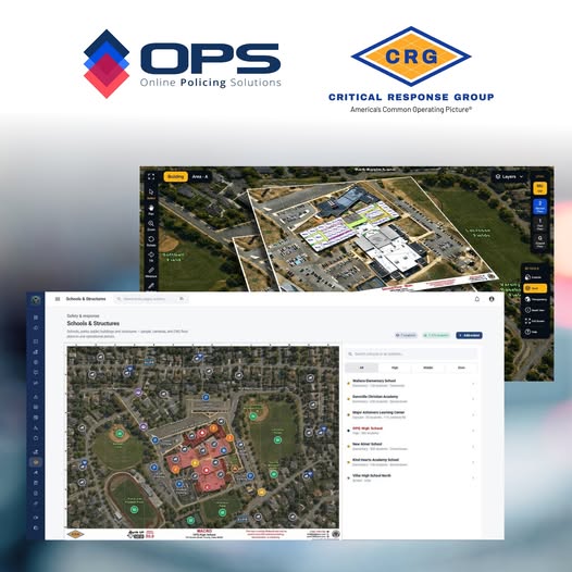
Proud to partner with the incredible team at Critical Response Group (CRG). With this new partnership, OPS and CRG bring civilian cameras, commercial cameras, ALPRs, OPS mapping data, and comprehensive CRG schools and building mapping together onto one centralized, cross-jurisdictional operational picture—accessible from anywhere, anytime.
Through OPS Schools & Structures™, OPS Community Cameras™, IMS|hub™, and NPS-AID™, OPS coalition partner agencies now have one central access point to critical information within a single operational environment—one that agencies across jurisdictions can operate from 24/7.
Combine the above with the incredible real world, cross-jurisdicational, collaborative power of OPS CONNECT 3.0, and the all-new OPS COMMUNITY 3.0, and agencies are now operating within the most accessible and comprehensive collaborative law enforcement coalition platform available today!
One ecosystem. One operational picture. One powerful network.
Learn more about this exciting new partnership and how you and your agency can join this incredible coalition by visting our CRG page.
FROM CRG:
Critical Response Group is proud to announce a new integration with Online Policing Solutions, bringing Collaborative Response Graphics® (CRGs) directly into the OPS Network™.
Serving more than 600 federal, state, county, and local law enforcement agencies, OPS is built around a shared mission of improving collaboration and connectivity across public safety. Through this integration, agencies can now access CRG mapping alongside cameras, ALPRs, OPS mapping assets, and other critical information within a single operational environment.
CRGs are integrated across OPS Schools & Structures™, OPS Community Cameras™, IMS|hub™, and NPS-AID™, giving responders access to detailed site grids, room labels, entrances and exits, critical infrastructure, floor-level information, and other response data without moving between separate mapping systems.
By bringing CRG and OPS capabilities together, command staff, field personnel, and partner agencies can work from the same map and the same location language when coordinating an incident.
We’re excited to welcome OPS to CRG’s growing partner ecosystem and continue expanding the ways our mapping can be accessed within the technologies public safety agencies already use.
America's Common Operating Picture®
www.crgplans.com